Short answer
A water well can have different water levels before, during, and after pumping. That is why a single entry labeled "depth to water" does not tell the whole story of a Texas property's water supply.
Illustrative drawdown example
If a well rests at 90 feet below ground and reaches 120 feet while pumping, the observed drawdown is 30 feet under those test conditions. After pumping stops, recovery measurements show how the water level moves back toward its resting position. Read the result with the pumping rate, duration, equipment, season, and measurement method.
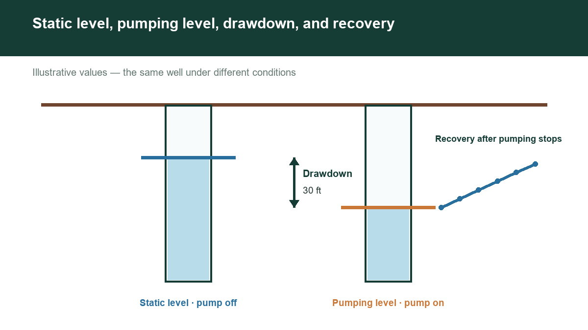
Static water level, pumping water level, drawdown, and recovery describe different conditions. Understanding the distinctions helps owners interpret service records and helps buyers avoid treating a historical measurement as a present-day performance test.
WHAT IS STATIC WATER LEVEL?
Static water level is the water surface in a well when it is not being pumped and has recovered sufficiently for the intended measurement. It is commonly reported as feet below a reference point, but always check the units and reference used in the record.
"Not pumping right now" does not necessarily mean fully recovered. Recent use or nearby pumping can still influence the reading. Ask when pumping stopped and what conditions were documented.
USGS explains that pumping changes groundwater levels around a well, creating a cone of depression. In confined aquifers, the change reflects reduced pressure as well as a change in the water level inside the well. [1]
WHAT IS PUMPING WATER LEVEL?
Pumping water level is the measured water surface while the well is producing at a stated rate. Record both the rate and elapsed pumping time; a reading after five minutes is not directly equivalent to one after several hours.
As an illustrative example, suppose water stands 110 feet below a fixed reference before pumping. After a measured test, it stands 155 feet below the same reference. The drawdown is 45 feet: 155 minus 110.
If the pump intake is at 220 feet, that example leaves 65 feet between the measured pumping surface and the intake. This calculation describes the test at that moment, not a universal safety margin. The acceptable operating level depends on the pump, completion, cooling requirements, and professional design.
DRAW DOWN THE RIGHT CONCLUSION
Drawdown is the difference between static and pumping water levels under the test conditions. A higher pumping rate can cause additional drawdown. A decline in static level over several seasons can also reduce the operating range available to the well.
Specific capacity expresses production per foot of drawdown. For example, an illustrative test of 9 gallons per minute with 30 feet of drawdown gives 0.3 gallons per minute per foot. USGS describes this relationship, but the result remains dependent on the test conditions. [2]
Do not use that ratio alone to predict a maximum sustainable yield. Research on fractured-bedrock wells shows that estimates can be misleading when pumping changes which water-bearing zones remain submerged. [3]
WHY RECOVERY MATTERS
Recovery is the rise in water level after pumping stops. A professional test can track the response over time and help characterize the well and aquifer. The time needed to recover is not necessarily constant across seasons or pumping schedules.
Ask for a record that includes the starting level, pumping rate, duration, measured levels, and recovery observations. These details make comparisons more meaningful than an isolated depth entry.
DON'T CONFUSE WATER ELEVATION WITH WATER DEPTH
Some records express the water surface as an elevation above a vertical datum rather than a distance below ground. Subtracting depth from land-surface elevation can estimate water-level elevation only when the reference points and datums are compatible.
Two wells with the same depth to water but different land elevations do not necessarily have the same groundwater elevation. TWDB's database explanation describes variable data accuracy and field-specific limitations; review those notes before making map-based comparisons. [4]
PUT THE MEASUREMENTS TO WORK
For an existing well, ask a licensed well professional to measure and interpret conditions safely. Do not open a well or work around electrical equipment merely to collect a reading yourself.
For a property you are researching, begin at https://www.groundwaterassessment.com/. Treat historical water levels as evidence that helps frame a current evaluation, not as a guarantee that a well will support your planned demand.
Sources
- [1] USGS: Groundwater Wells. Pumping and cones of depression.
- [2] USGS: Water-Resources Investigations Report 95-4165. Specific capacity definition.
- [3] USGS: Factors Affecting Specific-Capacity Tests and Their Application. Test limitations in fractured-bedrock wells.
- [4] TWDB: Explanation of the Groundwater Database.